PDP GIS - Decision Support System for Crop Selection
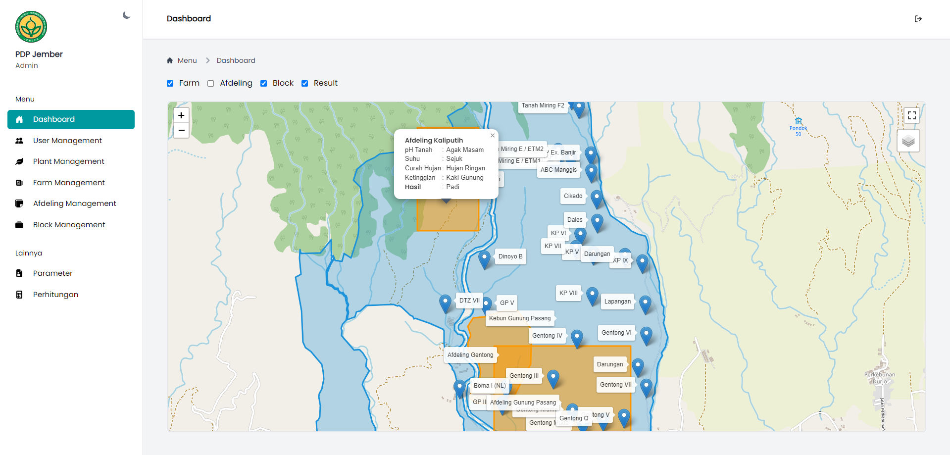
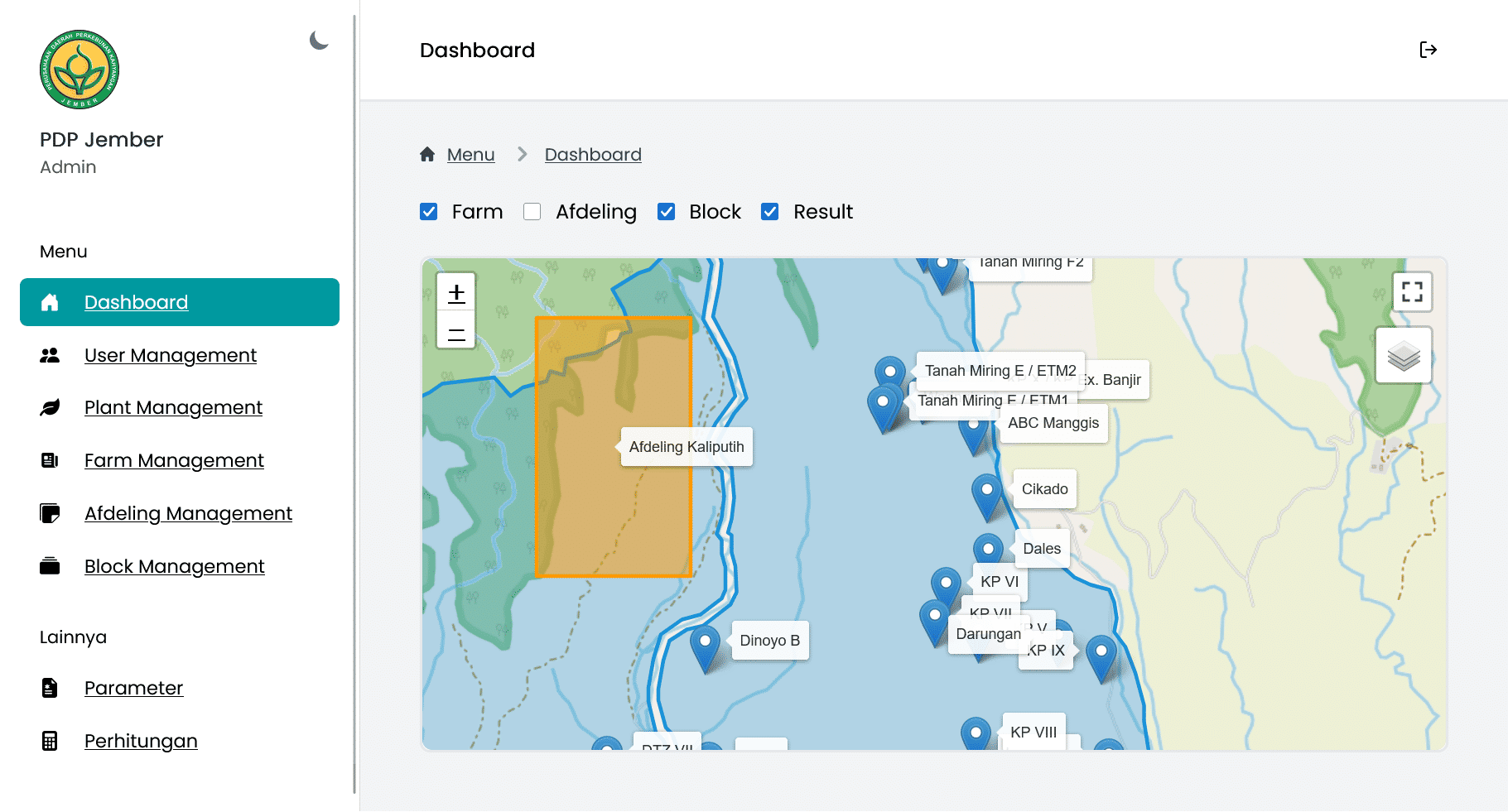
PDP GIS is a web-based decision support system designed to assist users in selecting suitable crops based on soil content. It leverages Geographic Information System (GIS) technology to visualize and analyze spatial data, and employs the Learning Vector Quantization (LVQ) method for data classification and decision-making.
Key Features
- GIS Integration: Visualizes and analyzes spatial data related to soil content.
- Learning Vector Quantization (LVQ): Utilizes LVQ for data classification and crop selection recommendations.
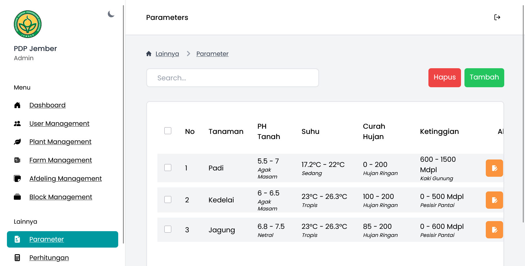
- Soil Content Analysis: Analyzes soil content to determine suitable crops.
- Decision Support: Provides recommendations for crop selection based on soil analysis.
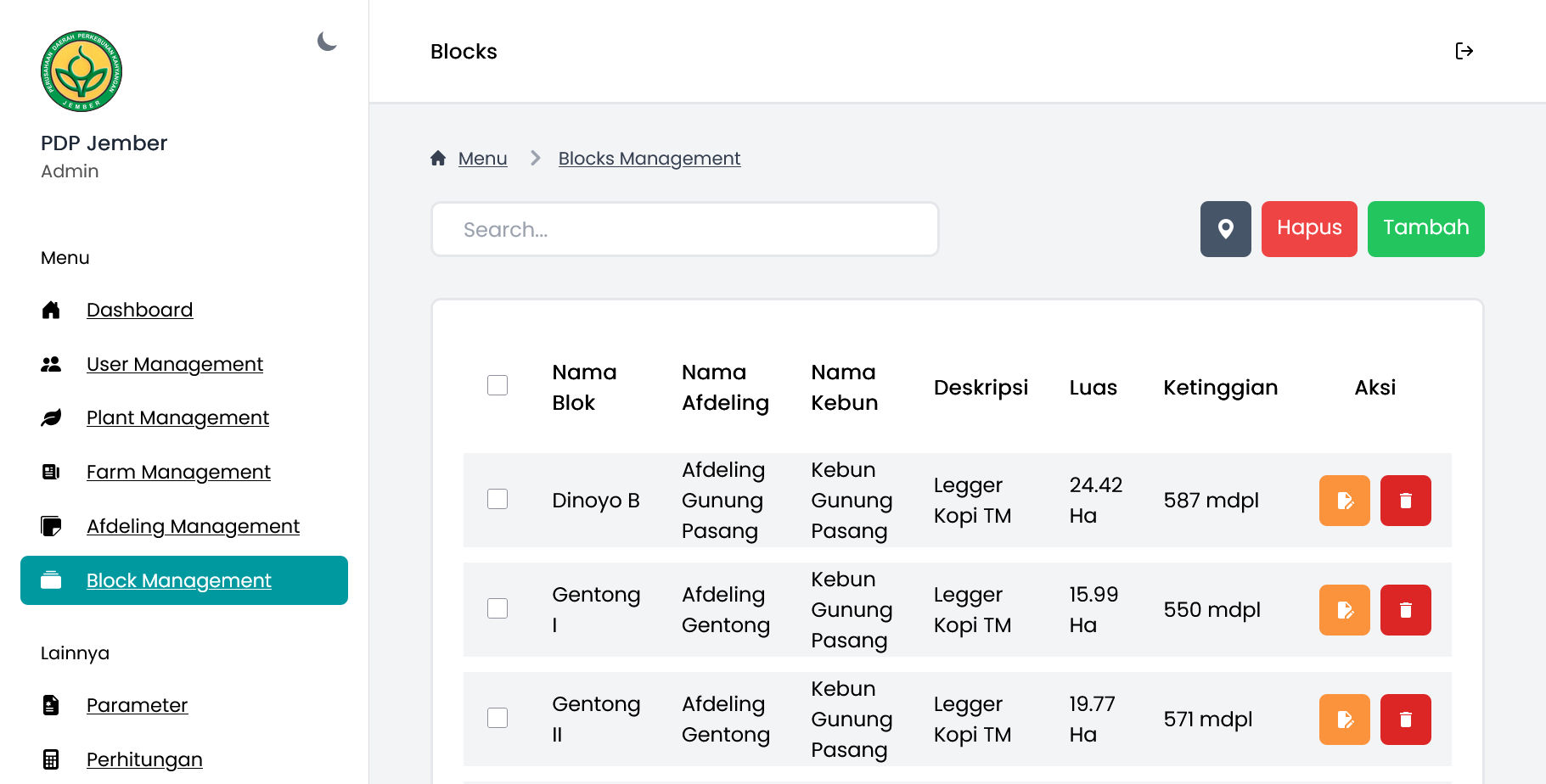
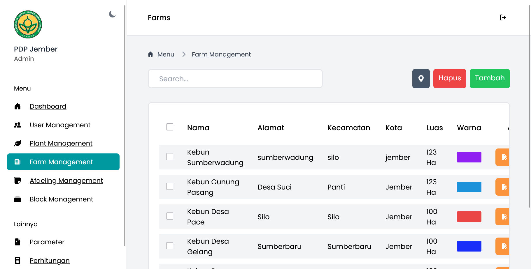
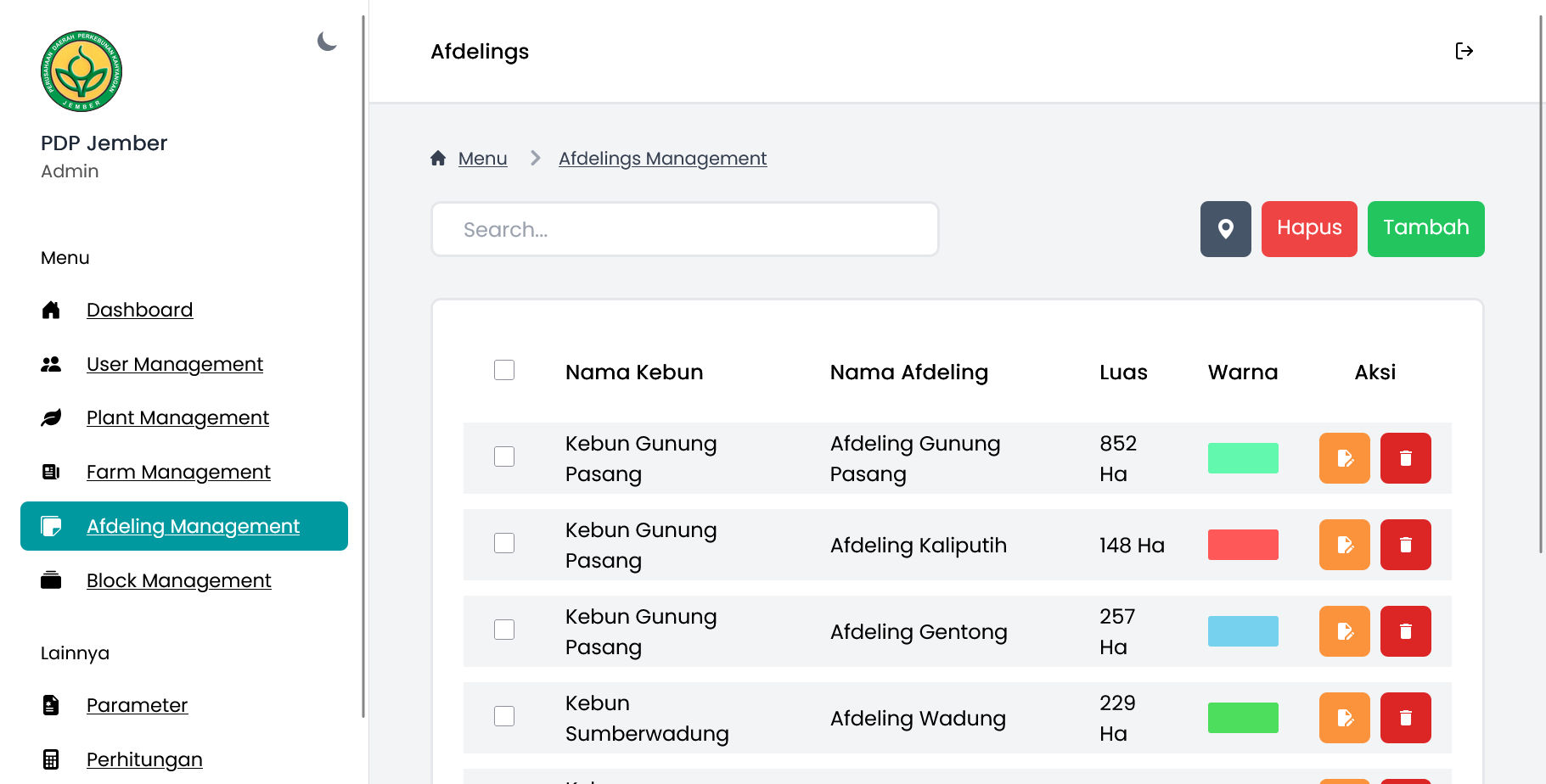
- Admin Management: tools for admin to manage data.
Screenshots
Technologies Used
- Laravel: A PHP web framework for building the application.
- GIS (Geographic Information System): For spatial data visualization and analysis.
- Learning Vector Quantization (LVQ): For data classification and decision-making.
- Sweet Alert: For user notifications.
- Laravel Notify: For user notifications.
- leaflet: For interactive maps and geospatial data visualization.
Getting Started
- Visit the GitHub repository: https://github.com/SideeID/pdp-gis
Contribution
Contributions are welcome. Please refer to the repository for contribution guidelines.